 Tartar – region in Azerbaijan. The name was Mir-Bashir during Soviet rule.
Tartar region is situated in north-east foothills of Lesser Caucasus and Garabagh Plain. Capacity is 957 km², population is 98, 1 thousand people (01.01.2009). Central part is City of Tartar.
History
Tartar is administrative region in the Republic of Azerbaijan. In April, 1920 Javanshir zone is created. On that year Tartar site was established and subject to Javanshir zone in 1920-1922 years, while in 1922 the nomination is changed and it called Javanshir site. The region was under administrative administration of Aghdam zone from 7 July 1923 to April 1929, and from 8 April 1929 to 8 August 1930, Garabagh district. Tartar region was created on 8August 1930. Tartar region is abolished on 24 February, 1931and given to administrative subordination of Barda region. Tartar region is re-established on 27 January, 1934. The name of the region was transformed to Mir-Bashir on 5 August, 1949. On 4 January, 1963 Mir-bashir region was liquidated and given to administrative subordination of Barda region. On 6 January, 1965 Mir-bashir region was re-created. On 7 February, 1991 Mir-bashir region was transformed to Tartar region again. Agdere region of the Republic of Azerbaijan was abolished by decision 327. dated 13 October, 1992 of Milli Majlis of Azerbaijan Republic. Agdere settlement of that region and 28 villages were given to administrative part of Tartar region. There are 2 towns, one settlement and 74 villages in the region including dwellings of Agdere region. Presently Agdere city surrendered from Agdere region to Tartar region and 13 villages are under Armenian occupation.
Geography
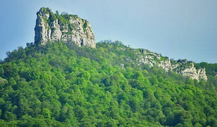
The surface of the region is plain in north-east part and mountainous in south-west. On the mountainous part there expanded Jurassic-Cretaceous, while on the plain anthropogenic sediments. Mineral products: oil, coal, construction materials, placer gold. Climate is warmer hot semidesert with arid summer and dry-field type and warm winter. Average temperature is in January from -2°C to 3°C, in July is 18-26°C. Annual rainfall 300-500 mm. Tartar and Injechay flow across the region area and Khachin River across south frontier. The area possesses chestnut-coloured, gray and grass-gray soils. There spread semideserts with wormwood and saline, sparse bush meadows, forests and subalpine grasslands.Tartar region is situated at the bottom of Tartar River and borders on Injechay on the north. Climate condition in the region starts from mild climate changing mild semidesert and desert climate. Tartar and Khachinchay Rivers flow through the area of this region. The region is situated in west part of Kur-Araz Lowland, in Garabagh Plain. Oil deposits and construction materials exist there. There are 58 settlements in the area of the region. Administrative centre of the region, Tartar city is located from right and left coasts of Tartarchay up to old caravan roads. Historical name of this place is Chaparkhana. A caravanserai and castle situated one time 17 km distance from Barda, old capital of Albania.
Historical and Architectural Monuments
There are 24 historical and cultural monuments. One of them is archaeological monument of world importance, 15 of them local importance, 7 of them are architectural monuments of local importance and one more archaeological monument of local significance. Those monuments are located in city of Tartar, villages of Buruj, Hajigarvand, Evoglu, Husanli, Sarov, Borsunlu, Bayim Sarov, Khoruzlu, Demirchiler. There exist mosques, 15 kurgans, 2 necropolis, 2 settlements, one ice-store and a tomb in the mentioned regions. Certain work is done in the line of repair and restoration of historical and architectural monuments in the region lately.